
Explore Our Comprehensive Suite of
Unlock Real-Time Geospatial Intelligence with Atlas Geo Technologies.
Services
Atlas Geo Technologies offers specialized geospatial and intelligence services for public safety, infrastructure, planning, and operational support.
- On-Demand GIS Mapping
- AtlasSafe Public Safety Intelligence
- Emergency Response Mapping
- Infrastructure & Zoning Overlays
- Dashboards & Web Mapping
- Spatial Analysis & Decision Support
Atlas Geo Technologies is your trusted partner in delivering fast, scalable, and cost effective mapping solutions anytime you need them. Whether you’re managing public safety, urban development, or infrastructure planning, we provide on demand GIS mapping with delivery windows as fast as 60 minutes, depending on your subscription level.
Through our 24/7 digital request platform, clients can submit mapping needs, access high-priority support, and receive professional grade GIS products tailored to critical operations. From emergency response layouts and zoning overlays to AI-powered growth projections and 3D city models, our solutions are designed to accelerate your decisions and reduce overhead.
Let Atlas Geo Technologies become your edge in real-time planning and disaster response.
Submit a request today and experience the future of mapping on demand.
On-Demand GIS Mapping Services
Atlas Geo Technologies provides responsive mapping and geospatial analysis services for organizations that need high-quality products without the cost and complexity of building a full internal GIS team. Clients can request maps, overlays, and spatial products for planning, operations, presentations, response activities, and decision support.
AtlasSafe Public Safety Intelligence
AtlasSafe is Atlas Geo Technologies’ public safety intelligence solution. It transforms crash, incident, and operational data into mapped insight, ranked priorities, and reporting outputs that support safer decisions. This service is ideal for agencies and organizations that need a practical way to detect patterns, communicate risk, and justify action through defensible analysis.
Emergency Maps
Rapidly developed maps for disaster response, incident coordination, event planning, and situational awareness. These products help teams understand conditions on the ground, improve coordination, and support time-sensitive decisions.
Infrastructure Overlays
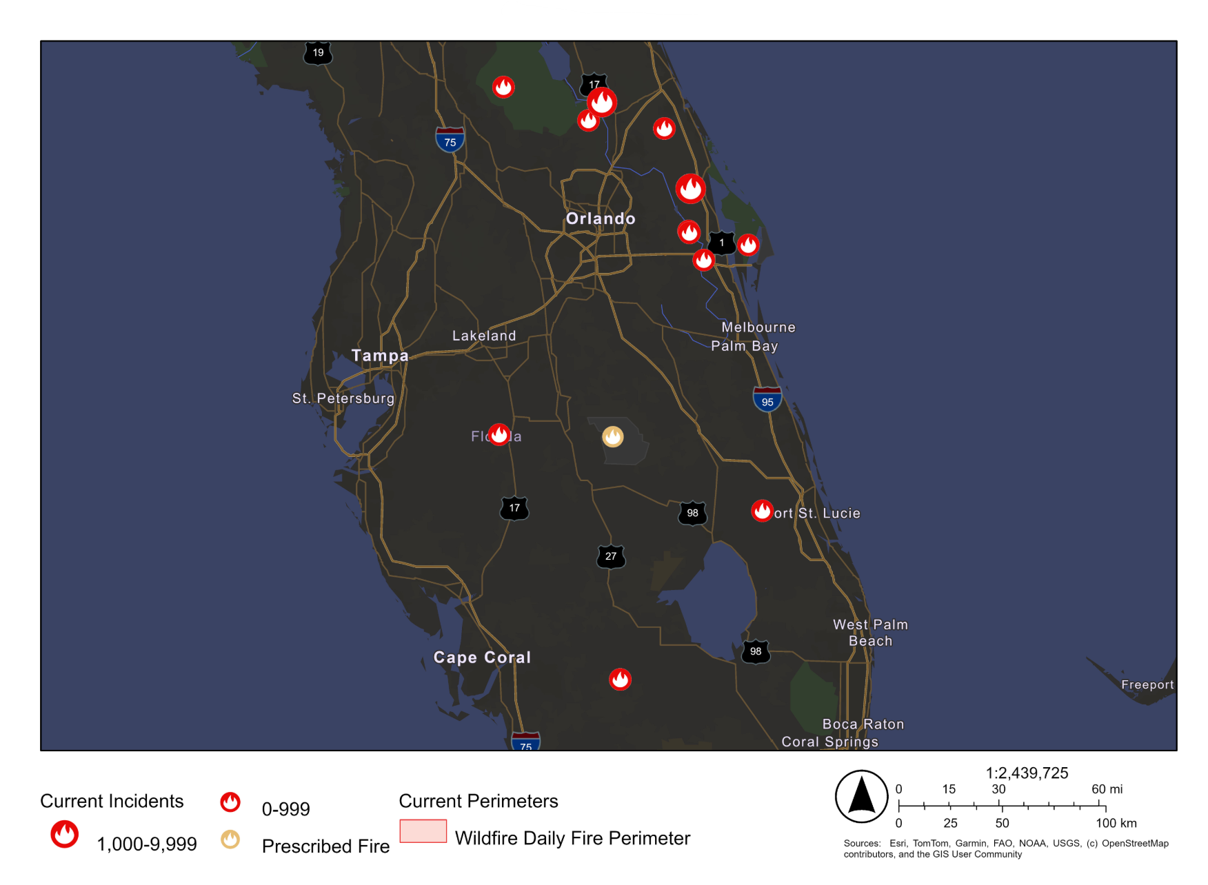
Emergency Mapping for Rapid Response
- Enhanced Situational Awareness: Gain a comprehensive view of the emergency area.
- Improved Response Times: Quickly identify optimal routes and resource locations.
- Effective Resource Allocation: Deploy resources where they are needed most.